
Construction support
Aerial mapping for the Virgin Islands, in the format your team opens.
Orthomosaics, DSM and DTM surfaces, contours, and Civil 3D surfaces — georeferenced to real ground control, delivered on your project’s own datum and units, and measurable at 0.10 ft. Not screenshots with a scale bar drawn on top.
What this covers
Six products off one capture.
Which of them you actually want depends on what opens the file at the other end. That question is worth settling at the scoping call, not after delivery.
Mapping and survey are scoped differently here, and the split is worth knowing. If the deliverable has to be signed, or the question behind it is a quantity in a pay application, that is drone survey. If what you need is measurable, georeferenced ground the whole team can work over, it is this page.
-
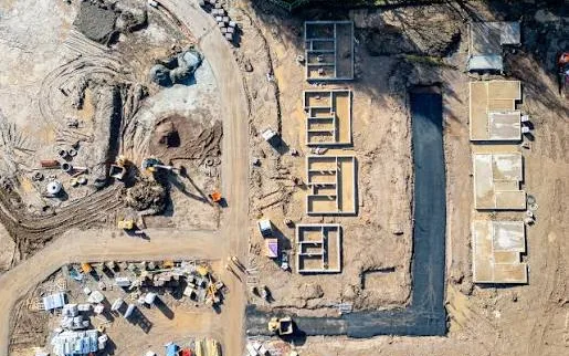
Orthomosaics
One scaled image of the entire site, corrected so a measurement taken at the edge means the same as one taken in the middle. It is the drafting background, the progress record, and the thing you send someone who will not open a DWG.
-
DSM and DTM surfaces
Two surfaces, and the difference decides which one you should be using. The DSM is everything the camera sees — canopy, roofs, stockpiles. The DTM is bare earth with that stripped out. Grading runs on the DTM; a stockpile does not.
-
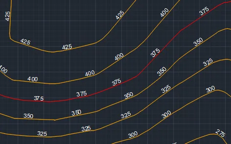
Contours at your interval
Generated at the interval your plan set actually uses, not the one that fell out of the software. Send a layer template with the scope and they arrive named the way your drawings already are.
-
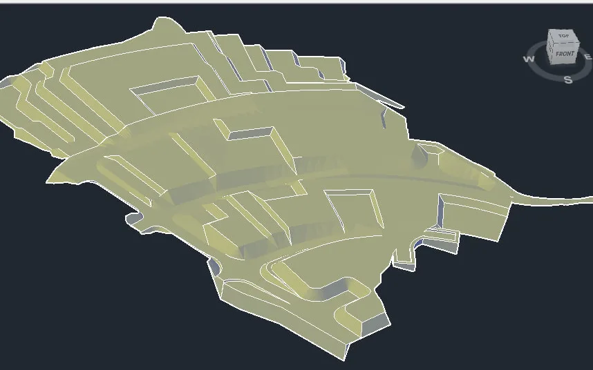
Civil 3D surfaces
Delivered as a TIN your civil team can attach directly — LandXML or a DWG that opens as a Civil 3D surface object, not a mesh of 3D faces nobody can grade against.
-
GIS-ready georeferenced tiles
GeoTIFF with the projection written into the file, and sidecar world and projection files where a consumer needs them, so a raster lands in QGIS or ArcGIS in the right place without being hand-positioned.
-
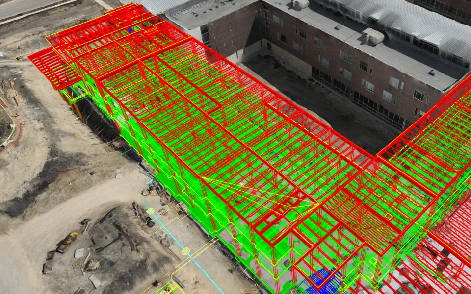
Change detection between flights
Two dated captures of the same ground, differenced, so movement reads as a number rather than an impression. Slope movement, stockpile draw-down, or progress against the schedule.
The word that does the work
What “georeferenced”
actually means.
It is the word separating a map from a photograph, and it is used loosely enough in drone marketing that it has almost stopped meaning anything. Here is what it means on a delivery from us, stated so you can hold us to it.
- Every pixel has a real coordinate. The projection is written into the file, so the image lands in the correct place in your CAD or GIS without anyone dragging it there.
- Tied to ground, not just to the aircraft. RTK fixes where the camera was. Ground control and check points fix where the ground is. You need both, or the map is confidently and consistently wrong.
- The datum is stated, horizontally and vertically. A coordinate without a datum is a number without units. Both are named on the delivery, and both match what your drawings already use.
- Units are stated, in US survey feet. Not converted at the end from something else and rounded on the way through.
- The residuals are published. The accuracy report lists the check point comparison, so your engineer accepts the surface on evidence rather than on our say-so.
What the metadata says
- Horizontal datum
- Your project’s own. Territory work commonly NAD83 / PR & VI State Plane (EPSG:32161)
- Vertical datum
- Your project’s own; VIVD09 where the job does not specify
- Units
- US survey feet
- Accuracy
- 0.10 ft horizontal and vertical on well-controlled sites, against withheld check points
- Control
- Ours, or your existing monuments where the site already has them
Deliverable formats
Pick the format by what opens it.
Most of the cost of a mapping job that goes wrong is spent converting a file that arrived in the wrong shape. This is the whole matrix, so that conversation happens before the flight.
| Deliverable | Format | Opens in | Best for |
|---|---|---|---|
| Orthomosaic | GeoTIFF + .tfw / .prj | Civil 3D, QGIS, ArcGIS | Scaled background you draft and measure over, and the image a non-CAD reader can actually open. |
| Point cloud | LAS / LAZ | Civil 3D, ReCap, CloudCompare | The source measurement. Keep it and a surface can be re-cut later against different breaklines without reflying. |
| Surface model, DSM | GeoTIFF raster | QGIS, ArcGIS, Civil 3D | Top-of-everything elevation: canopy, roofs, stockpiles. What you measure a pile against. |
| Surface model, DTM | LandXML / DWG TIN | Civil 3D | Bare earth, vegetation stripped. What grading, corridors, and cut/fill run against. |
| Contours | DWG / DXF | AutoCAD, Civil 3D | Sheet background at your stated interval, on your own layer template. |
| Change detection | PDF + GeoTIFF | Any viewer, plus GIS | Difference between two dated flights, with the capture date of each stated on the sheet. |
Two formats are worth a second look before you choose. A DSM and a DTM are not interchangeable: asking for “the surface” and receiving the wrong one of the two is the single most common cause of a grading model that reads high. And a DWG containing 3D faces is not a Civil 3D surface, however much it looks like one on screen — if your team needs to attach it as a surface object, say so and it arrives as LandXML.
If what you need modelled is a building rather than the ground, that is scan to BIM. If you need a dated visual record of an active site rather than a measurable surface, that is a 360° job walkthrough.
Where we work
Relief decides the flight plan.
Mapping problems differ by island, and mostly because of vertical relief. It changes altitude planning, overlap, and how far a DSM and a DTM diverge.
-
St. Thomas
Sharp vertical relief over short horizontal distances, so a single flight altitude produces very different ground sample distances between a ridge and the harbour below it. Altitude is planned to the terrain, not to the parcel.
Mapping on St. Thomas → -
St. Croix
Open, comparatively flat parcels where area is the constraint rather than access. This is where a single mission covers the most ground, and where corridor work pays for itself against a walking crew.
Mapping on St. Croix → -
St. John
Heavy canopy over much of the island, which is where the gap between a DSM and a DTM is widest. Expect the bare-earth surface to need ground shots through the gaps, and expect us to say where it did.
Mapping on St. John →
Questions we get
Before you choose a format.
What is an orthomosaic?
A single image of the whole site with the perspective taken out of it, so scale is constant everywhere in the frame.
An ordinary aerial photograph leans: objects tip away from the centre, and a distance measured at the edge does not mean the same thing as one measured in the middle. An orthomosaic corrects that using the camera positions and a surface model, so every pixel sits at its true ground coordinate. That correction is what makes it a drafting background you can measure off, rather than a picture of a site.
What accuracy can I measure at?
0.10 ft horizontal and vertical, in US survey feet, on well-controlled sites, verified against independent check points withheld from the photogrammetric solution and reported per job.
That figure describes the georeferencing, which is not the same thing as pixel size. A small ground sample distance makes fine detail visible; it does not by itself make a measurement correct. Detail comes from altitude and sensor, correctness comes from the control under the flight. A vendor quoting you centimetres of GSD has told you how sharp the picture is, not how right it is.
What coordinate systems do you deliver in?
The one your project already runs on. Send it with the scope and the deliverable arrives on it, rather than arriving on ours and needing to be re-projected by whoever opens it first.
Territory work commonly sits on NAD83 with the Puerto Rico and Virgin Islands State Plane projection (EPSG:32161) horizontally, and VIVD09 vertically, in US survey feet. If the job runs on a site calibration or a local assumed system, we hold that instead and say so on the delivery.
Separately, the National Geodetic Survey is modernizing the National Spatial Reference System, which will in time replace NAD83 and the current vertical datums with new reference frames. The rollout has moved more than once and we are not going to guess at a date here. It does not change the answer either way: name the frame your project is specified on, and that is what the deliverable arrives on.
Can you match my existing control?
Yes, and on a site that already has control it is usually the right call.
Where a previous survey set monuments, we tie to those rather than establishing an independent network. Two networks over one site produce two datasets that are each internally correct and offset from each other by a tenth or two, and reconciling them later costs more than tying in properly at the start. Send the control sheet with the scope. Where the mapping has to agree with a signed survey, see drone survey.
How large an area can you cover in one flight?
It depends on three things: the ground sample distance the deliverable needs, the relief of the site, and the airspace.
An open, flat parcel covers far more ground per battery than a steep hillside, where the aircraft has to hold altitude above the ground rather than above sea level and the flight lines tighten to keep overlap. Controlled airspace adds coordination time rather than flight time. The proposal states the area and the number of days rather than leaving it open.
Tell us about the site.
Send the island, the parcel, and what you need out the other end. We’ll come back with a scoped, fixed-fee proposal within one business day.